Rows of kale, eggplant, corn, and other late summer vegetables extend for nearly 5 acres across one corner of Horseneck Farm in early September, located just a few miles south of downtown Kent. On a clear day, Mt. Rainier towers behind the trees in the distance. This setting – a small, green retreat within a hub of manufacturing – is just one of five King County-owned farms leased to area farmers through its Farmland Leasing Program. The goal is for marginalized and beginning farmers to have land access to grow their agricultural businesses despite increasingly expensive property prices across the county.
Using beautiful drone footage and captivating underwater salmon photography, the Snoqualmie Watershed Forum tells the story of diverse partners in the Cherry Valley working together to recover salmon, while protecting farmland and reducing flood risks.
Hear about the challenges and successes from representatives of the Tulalip Tribes, Snoqualmie Indian Tribe, Washington Department of Fish and Wildlife, Sound Salmon Solutions, Snoqualmie Valley Watershed Improvement District, Wild Fish Conservancy, Snohomish Conservation District, and Drainage District 7.
The Snoqualmie Watershed Forum has been working since 1998 with partners to address salmon recovery, water quality, and flooding. Nowhere is this more evident than in Cherry Valley, where the partners are working to revive the landscape.
The Forum is a signatory and committed partner of King County’s Fish, Farm, & Flood Initiative. It is clear what needs to be done to recover salmon, protect farmland, and reduce flood risk, but it can’t be done without partnerships. Take action and learn more at govlink.org/action7.
This year the COVID-19 pandemic and the need for social distancing required field inspections take place with a different protocol to keep staff safe. Despite this additional challenge and the vast number of facilities to inventory, staff completed inspections on all 511 river facilities in one year – an activity normally done over a two-year cycle.
King County staff inspect a damaged revetment on the Snoqualmie River in July 2020.
The 2019-2020 flood season was one for the record books. The first flood event took place on the Snoqualmie River in October 2019 and the season concluded with a total of seven flood events having occurred in King County by the end of February 2020.
Damage was found on 136 facilities and plans for emergency repairs or longer-term improvements to remedy the damage are underway. This assessment and planning is critical in order to prepare for another flood season which began on October 1 of this year.
Flooding pictured from helicopter on the Cedar River in February 2020.
The flooding was due to extensive rain throughout western Washington. Average monthly rainfall totals throughout the region in December 2019, January and February were far greater than normal. After the widespread flood in February that received a Presidential Major Disaster Declaration, conducting post-flood inspections and triaging damage to river facilities was a high priority for the King County Flood Control District (Flood District).
River facilities, such as leveesand revetments, play an important role in protecting people, neighborhoods and infrastructure against damage from erosion and flooding. The King County Water and Land Resources Division, as the primary service provider to the District, maintains more than 370 revetments and 130 levees across six river basins from the South Fork of the Skykomish River in the north to the White River in the south on the border with Pierce County.
Photo of a revetment on the Cedar River taken during an inspection visit in February 2020.
Each river facility is scheduled for inspection on a two-year cycle to look for any damage that could weaken its effectiveness. Inspections largely take place in the spring and summer or after a flood event and involve trained staff making careful observations of the riverbank facilities as well as floating the river in boats to identify potential problems.
Everyone in King County is encouraged to be flood ready. Information on what to do before, during and after a flood is available at kingcounty.gov/prepareforflooding.
About the King County Flood Control District
The King County Flood Control District is a special purpose government created to provide funding and policy oversight for flood protection projects and programs in King County. The Flood Control District’s Board is composed of the members of the King County Council. The Water and Land Resources Division of the King County Department of Natural Resources and Parks develops and implements the approved flood protection projects and programs.
About the King County Water and Land Resources Division
The Water and Land Resources Division works to protect the health and integrity of King County’s natural resources. Employees work to reduce flood risks, monitor water quality and restore wildlife habitat; manage, and reduce the harmful impacts from stormwater, noxious weeds and hazardous waste; create sustainable forestry and agriculture; and protect open space to support all of these efforts.
On any given day, the people in the Water and Land Resources Division are working on everything from the broadest of environmental issues of our landscape, to the microscopic work that takes place in our lab to provide one of the most crucial assets in our field – data. From stewarding the region’s expansive forests, to measuring organisms that are invisible to the naked eye in our waterbodies, there is no job too big or too small for us to take on to help ensure clean water and healthy habitat in King County.
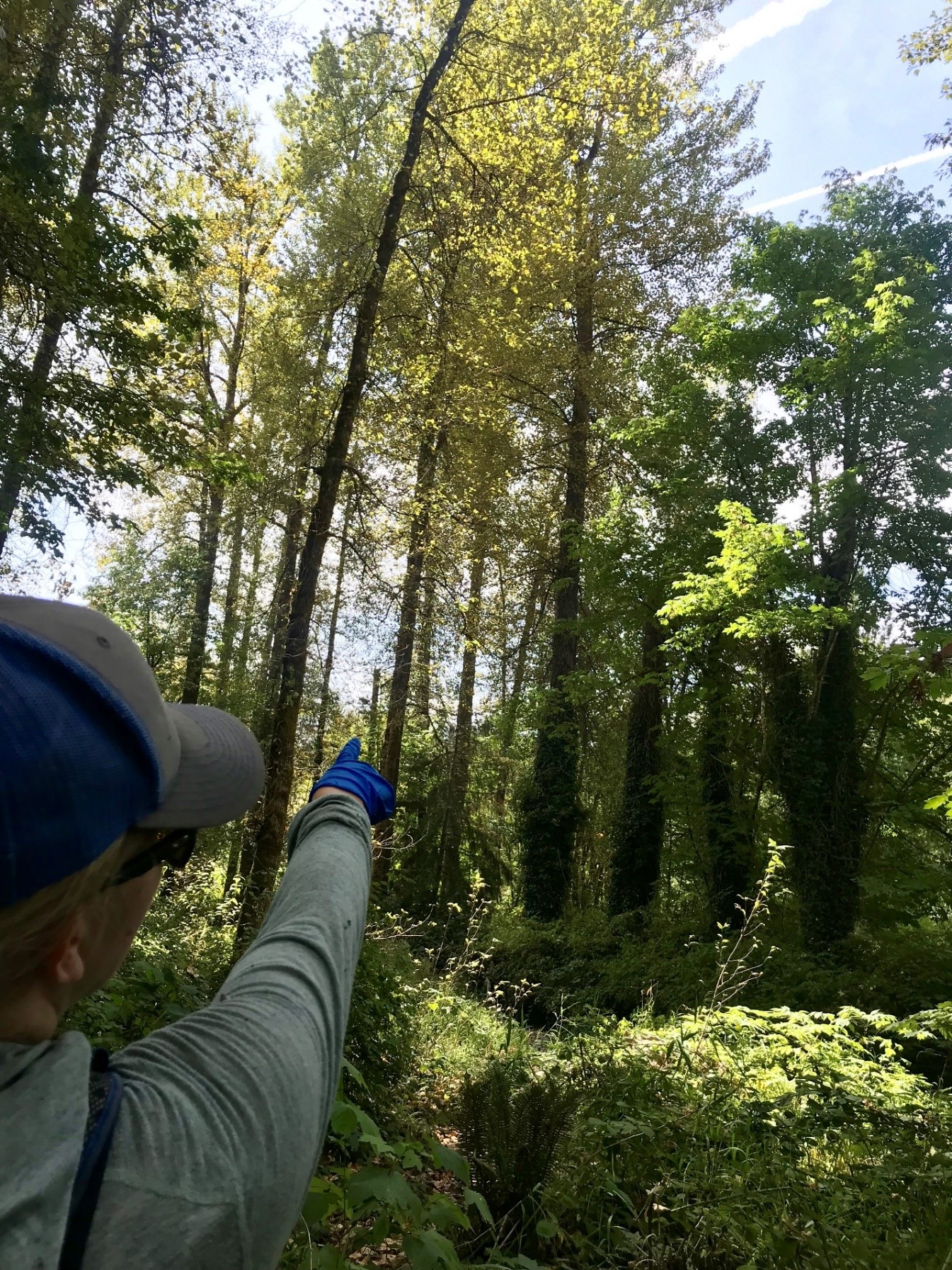
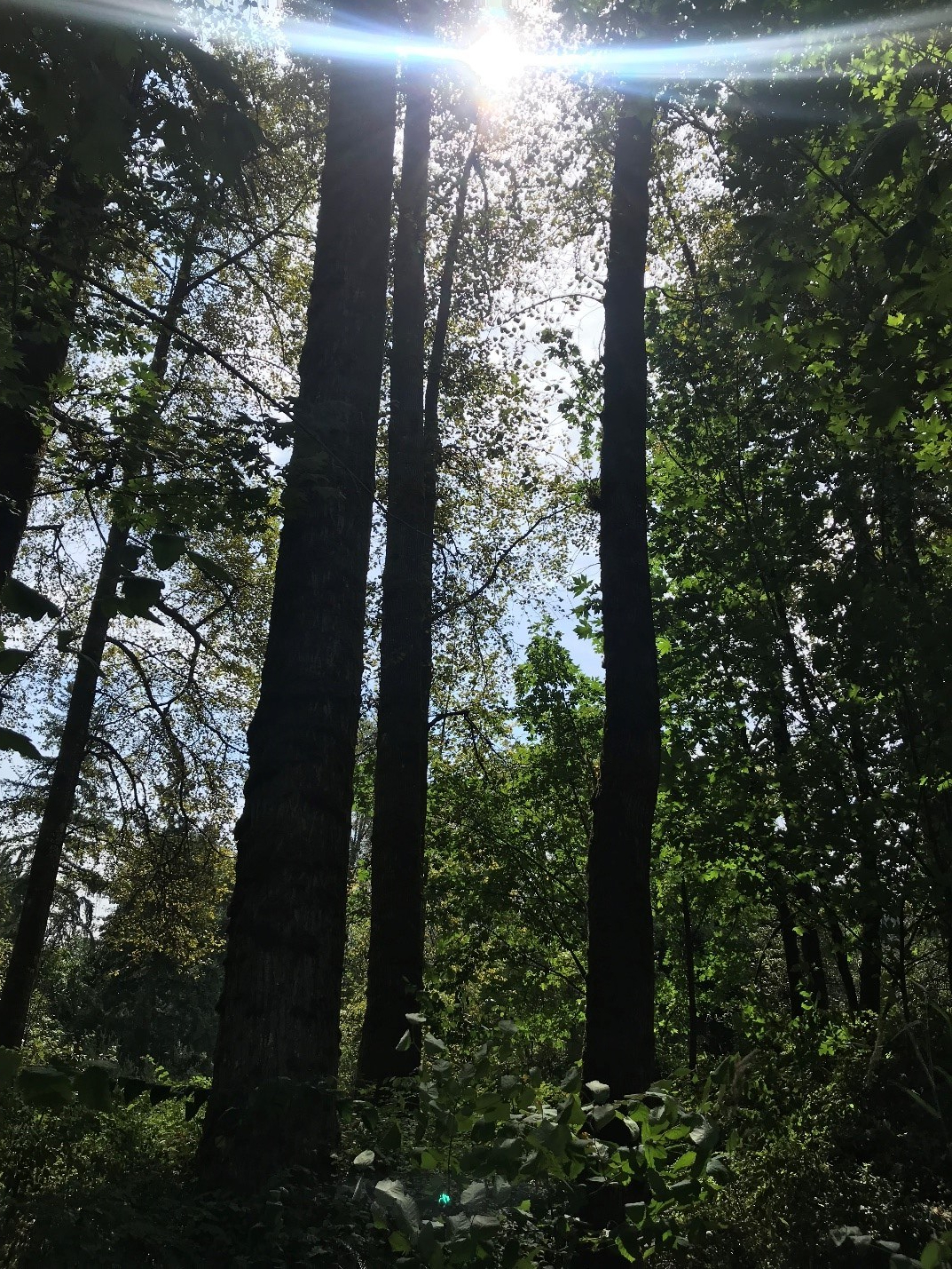
From flagellates under a microscope to hundred-acre forests, WLRD supports the entire watershed.
“The Water and Land Resources Division carries out a very diverse mission. Using nearly a dozen different funding sources, we provide the science and the technical expertise to support residents and decision makers in their stewardship of our natural resources. Like our sister divisions that serve as wastewater and solid waste utilities, we are, in essence, a watershed utility.”
Josh Baldi, WLRD director
A significant proportion of our workforce spend their days in the field monitoring the effectiveness of our projects and programs; preventing or eradicating threats to our environment; building or repairing critical infrastructure that is unseen by the casual observer; meeting with residents to provide technical assistance for their land or business; and protecting or restoring the habitat that the region’s native species rely on.
The Noxious Weed Control Program crews created safety guidelines to work together in the field.
When the COVID-19 emergency hit, WLRD staff quickly adopted new safety practices for field and lab work and deployed new online tools for public engagement and partner meetings to continue delivering essential services to our customers safely and without interruption.
Under the microscope, behind the data
The King County Environmental Laboratory was already well into a major construction project to replace critical infrastructure – fume hoods and heating systems – when the impacts of the COVID-19 pandemic fully hit. Employees at the lab acted quickly to continue essential sample analysis required for public health, water quality permit compliance, public swimming beach monitoring, and support for the Solid Waste and Wastewater Treatment divisions.
A construction project to replace a major portion of the lab’s environment was in progress during the pandemic.
Workflows drastically changed to maximize teleworking; moving from paperwork to digital platforms and ensuring safe distancing for in-person work at the laboratory. Communication with our customers and the public never slowed, and County programs continued providing essential services. (Check out, The King County Environmental Lab: Resilience and Adaptation Under Pressure.)
Teams of WLRD scientists adapted monitoring practices to ensure the safety of field staff by adjusting for social distancing, wearing masks, and conducting training and planning sessions outdoors or by teleconference.
Field teams continued to do monitoring using masks and social distancing practices. Some employees’ environments made it easier to social distance.
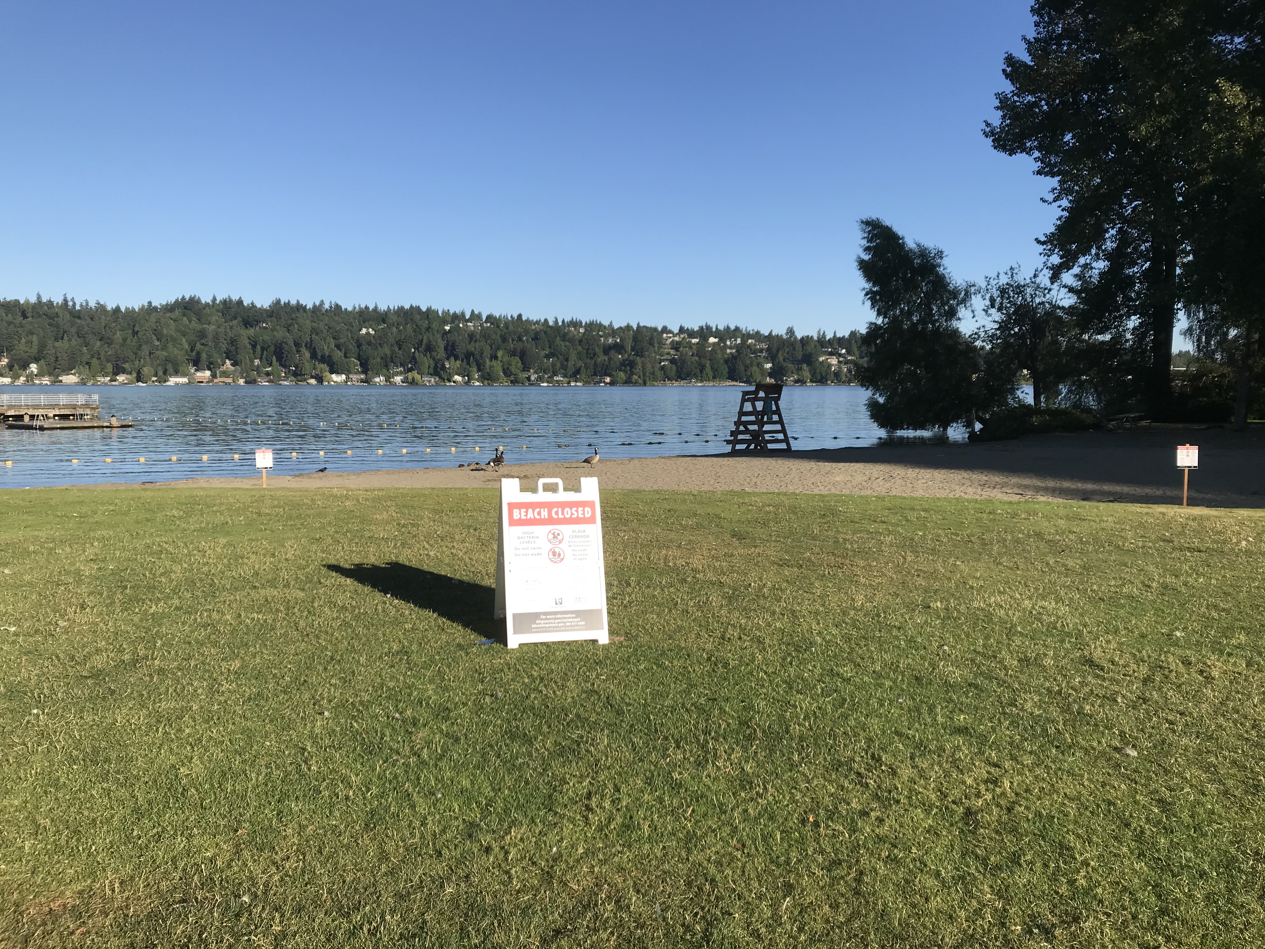
WLRD’s scientists continued their collaborative work with Public Health – Seattle & King County to monitor the health and public safety of swimming beaches; generated new research about threatened juvenile Chinook salmon in the Snoqualmie River; continued their groundbreaking work to preserve imperiled Lake Sammamish kokanee salmon by partnering with a private hatchery on Orcas Island; and promoted and coordinated best practices for managing beavers.
Providing water quality sampling and analysis to beach managers allows them to protect people and pets from getting sick.
Responding to multiple disasters
In early 2020, before COVID was a household word, King County responded to the most severe flooding in decades which led to a Presidential Major Disaster Declaration, the 13th declaration of this kind since 1990.
During flooding on the Cedar River in February, the Riverbend Lower Levee was washed away, which achieved a major aspect of the planned project to widen the floodplain.
Due to the severity of the flooding countywide in January and February, damage inspection of all 511 levees and revetments – normally done biannually – was accelerated and completed by October to quickly schedule any needed repairs. Levees and revetments are essential facilities that help to reduce flood and erosion risks to life and safety, homes, roads and farms and other businesses.
In 2020, six repair projects and seven flood-risk reduction projects were completed across six river basins. The Flood Warning Center, now in its 60th year, restructured operations to ensure continuity in delivering critical flood information to agencies and residents while adhering to social distancing guidelines brought about by COVID-19. A new Countywide Capital Team was created to expand capacity for responding to urgent river facility repairs. WLRD is the primary contracted service provider to the King County Flood Control District for flood warning, facility inspection and repair, and flood hazard management capital projects.
New programs and pandemic support
King County launched the nation’s first County-led Forest Carbon Program, to sell carbon sequestration credits. The revenue supports the King County Land Conservation Initiative and provides incentives for preserving and enhancing privately owned and managed forests. The program received an award from the National Association of Counties for innovation in sustainability.
The Forest Carbon Program offers local companies the option to offset their carbon emissions which helps to protect the forests in our community.
Forest restoration projects that improve forest health and enhance opportunities to sequester carbon have increased and directly contributed to the success of planting 1 Million Trees with partners across King County.
WLRD’s leadership through the King County Farmland Preservation Program over the past 40 years has kept nearly 16,000 acres of the best farmland available for production. Focused on equitable outcomes, the program also ensures land access is available to underserved communities and new farmers.
King County’s farming industry was hit hard by COVID-19. Our agriculture team responded by helping launch the Local Food Finder map, connecting consumers directly with farmers when farmers markets and restaurants closed or reduced service early in the pandemic. The ag team also supported the distribution of $1.4 million in federal CARES Act funding to support farmers, farmers markets, food banks and senior centers.
Clean water, healthy habitat
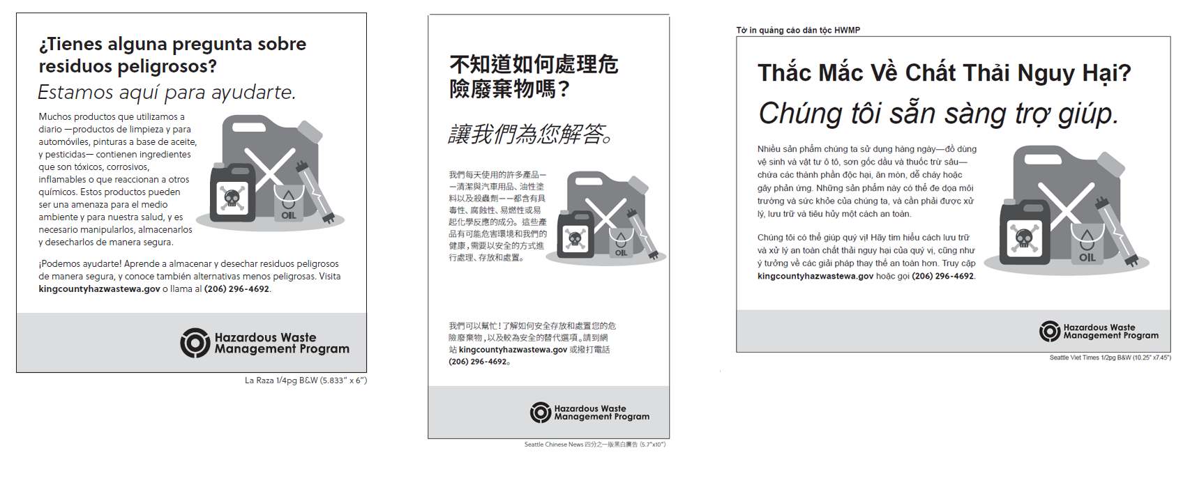
Water and Land staff are part of the regional Hazardous Waste Management Program to reduce exposure to hazardous materials and prevent toxic compounds from entering the environment. All prevention services were shifted to online and phone-only services. Vouchers were offered for hazardous materials management and personal protective equipment was distributed. A new website increased access to information about natural yard care, safe disposal of hazardous materials, and water quality protection by offering this information in 13 languages. The “Guilt Free KC” and “Ojo con el Cloro” (“Careful with Bleach”) campaigns promoted safe hazardous waste disposal and safer cleaning practices to protect human health and the environment – especially relevant as people turned to harsh chemicals like bleach to rid their homes of germs during the pandemic.
Examples of multilingual outreach materials available being used by the Hazardous Waste Management Program to increase access and education and reduce toxic substances from entering the environment.
Landward, the Noxious Weed Control Program developed new field safety protocols to keep employees safe as they continued to control noxious weeds to protect people and the environment. Priority was given to high-risk infestation control that put people and critical resources in danger, and to property owners highly impacted by noxious weeds. Despite challenges, knotweed control was maintained on the Cedar, upper Snoqualmie, Skykomish, middle and lower Green rivers, and Soos Creek. In all, specialists surveyed more than 8,000 infestations of regulated noxious weeds, 86 percent of which were controlled.
The Noxious Weed Program’s Healthy Lands Project (HeLP) carried out weed control on more than 20 new public and private open space parcels, improving public benefits and supporting green jobs on nearly 70 acres. HeLP supported the new North Highline open space property purchased by King County Parks through a new match-waiver program that increases open space for underserved communities.
By providing noxious weed control on land acquired by King County for open space ensures the land is healthy and available for everyone.
Adjusting to the world of on-line presentations, staff competed for state-managed grants for Floodplains by Design and Puget Sound Acquisition and Restoration dollars and received number-one rankings in both highly competitive programs for construction of the Fall City Floodplain Restoration Project to restore 145 acres of floodplain process and reduce 100-year flood elevations on over 300 acres of Snoqualmie River habitat. The grants would put the division in position to construct the roughly $15 million project in 2022.
Managing stormwater is another key component to protecting water quality. In 2020, significant steps were taken toward developing a Green Stormwater Infrastructure incentive program within unincorporated King County. Additionally, the Our Green Duwamish coalition used innovative tools to engage partners watershed planning efforts for increased clean water.
Stormwater management includes moving runoff through a system of pipes and culverts, many of which are known barriers to fish passage that hamper efforts to restore weak fish populations. Removing these barriers is one of the most effective ways to quickly restore salmon habitat access. King County Fish Passage Restoration Program employees spent 2020 in the field creating an inventory of these barriers around the county.
As of November, the field crew had completed 1,438 site visits in 2020, reaching a total of 2,851 site visits since spring 2019,and identifying almost 800 fish passage barriers at County assets. The next step is to determine how removing these barriers will be prioritized to help the most fish get to the best habitat as soon as possible.
The above video shows chum spawning inside the new Green River Road box culvert into Mary Olson Creek near Auburn. The use of the culvert by fish so soon after construction was completed, shows the success of the design and construction of the project by the King County Roads Division.
Supporting and protecting King County’s watersheds ranges from creating expansive, multi-generation visions for our work, to monitoring the smallest organisms and connecting their health to ours. It is work done in the field, in the lab, and now via online video calls. All of it is done with respect to the safety of our employees and the commitment to our work.
Between Seattle and Auburn, drivers cross over countless creeks and rivers. Each fall, salmon and steelhead swim a similar journey from Puget Sound, up the Duwamish River leading to the Green River, and into many tributary streams around Auburn. These creeks are vital habitat for salmon. Streams provide areas for salmon to reproduce, hatch, and grow, so young salmon are plentiful and healthy when they enter the ocean.
After leaving local waterways, salmon and steelhead spend several years in the Pacific Ocean before returning to King County waterways to repeat the cycle.
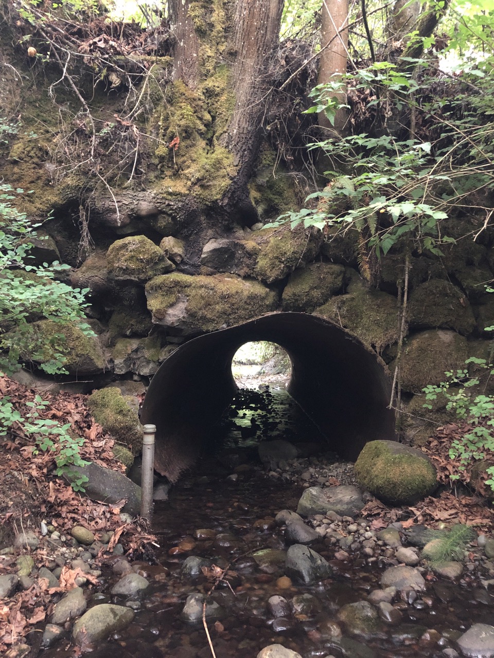
Just like people rely on roads to cross over creeks as they move throughout the region, salmon and steelhead rely on barrier-free creeks flowing under roads to reach vital upstream habitats.
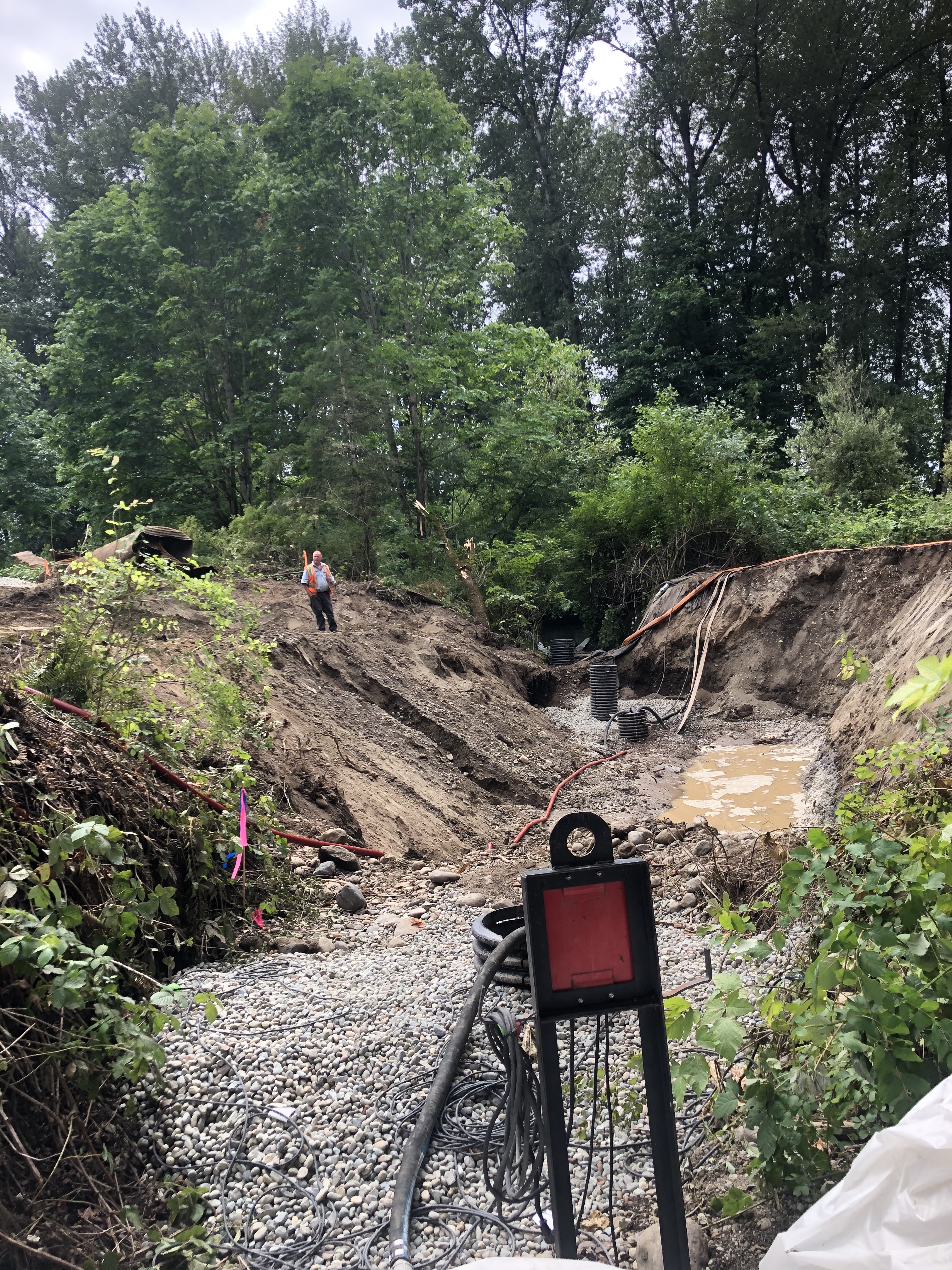
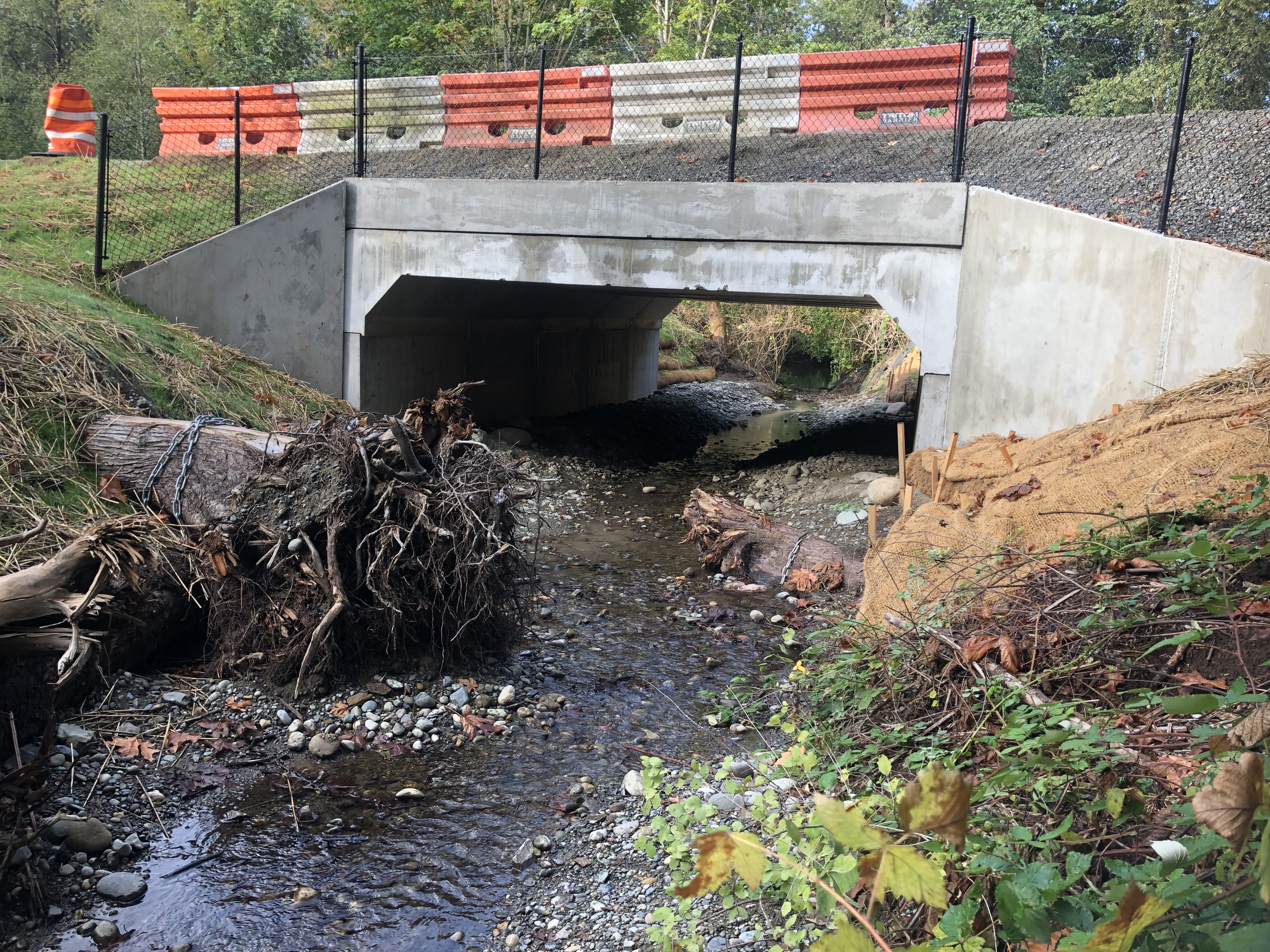
BEFORE: The culvert that conveyed Mary Olson Creek under Green River Road near Kent.
This summer, King County Roads replaced a culvert carrying Mary Olson Creek under Green River Road near Kent. This project ensured that the road crossing the creek is up to current standards and restores fish passage to Mary Olson Creek. Prior to the project, a metal pipe or “culvert” carried the creek under the road. This culvert was old and in poor condition. It was also too small and steep for most fish to swim through and blocked salmon from migrating upstream of the road.
DURING: During construction to replace the old culvert with a new, wider box culvert.
The new creek crossing uses a box culvert that is wide and deep enough to make sure that the creek under the road is “passable” for all species of fish, including salmon and steelhead. This work opens up more than 2,000 feet of stream habitat to full access by salmon and steelhead.
AFTER: The new box culvert that is wide and deep enough to make sure that the creek under the road is “passable” for fish to access spawning habitat.
The county completed construction of the new culvert in late August and this fall, the county will plant some trees and shrubs along the creek channel to improve habitat conditions. The project, which cost about $900,000, provides a road crossing that benefits all, whether they are people travelling on the road or fish swimming in the creek.
UPDATE: This video, taken Nov. 18, 2020, shows chum spawning inside the new Green River Road box culvert into Mary Olson Creek near Auburn. The use of the culvert by fish so soon after construction was completed, shows the success of the design and construction of the project by the King County Roads Division.
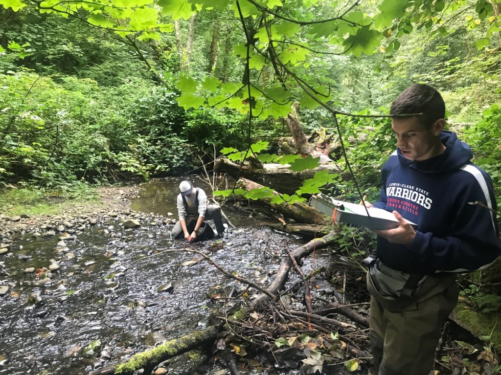
Hard at work: King County’s seasonal Stream Team collect bug samples in Coal Creek Natural Area in Bellevue, Washington.
Editor’s note: this story was written prior to the pandemic and social distancing requirements were in place. Team members are currently using masks and social distancing protocols.
Hands down, one of the coolest job at King County is working with the stream bug monitoring program, and arguably one of the most underappreciated.
Stream bugs don’t generate the same hype as salmon or Orcas, but they’re deserving of the same attention. Maybe this has something to do with the fact that most of us associate verbs like squashing, swatting, and killing with the word bugs. Regardless of how we humans feel about them, bugs rule the world, and we’d be wiser to learn to share it with them.
King County’s stream bug monitoring team thinks differently about bugs. They recognize the important role bugs play as indicators of the health of Washington’s watersheds.
On this field day, members of King County’s Stream Team collected samples from a handful of streams in Bellevue, Washington. Their first stop was the Coal Creek Natural Area, an urban greenspace that is just big enough that you forget you’re in a major metropolitan city.
The team was looking for benthic macroinvertebrates – think bottom dwelling bugs that live in the gravel, wood, and other debris in a stream. The team is particularly interested in documenting bugs that live in the riffles of the stream.
“The bugs we want to find are more diverse and plentiful in riffles,” explains Emily Rahlmann, a seasonal Stream Team member. A riffle is important habitat where fast moving water supplies plenty of oxygen that stream bugs to need to survive.
But why care about the little creepy crawlers in a stream?
“Bugs are super good indicators of what is going on in a stream, as well as the whole health of the watershed,” Tristan Hites, another seasonal Stream Team member explains. He’s right. The presence or lack of stream bugs says a lot about the health of a stream, and the larger ecosystem. According to the stream bug monitoring program, “bugs play a crucial role in the stream nutrient cycle. If bug populations are suffering it will affect the whole ecosystem.” That means that without bugs, growing fish have nothing to eat, and without fish, ocean predators have nothing to eat, and so on and so forth in a trophic cascade that is bad for everyone, including us.
Meet a stonefly nymph. This type can spend 2 years in the stream before molting into an adult and venturing to the land to mate and die.
The teams work in twos and will sample an area of the stream containing four riffles. One team member will collect bug samples from a riffle using a tool called a Surber sampler while the other team member will take measurements of the stream and outlying area in order to learn more about overall health of the surrounding ecosystem. When they move to a new stream, they alternate responsibilities.
A Surber sampler is like an underwater butterfly net that collects insects into a plastic receptacle at the end of a net.
Emily starts with the Surber sampler, a net fixed to a square brass frame that when seated firmly against the streambed allows water to flow into a plastic receptacle at the net’s end. She explains the Surber sampler is handmade by a local company and it is arguably the most valuable tool they have. One worth taking care of. Oh yeah – one crucial step to this process is digging up the riffle with a “weed tool” in order to shake loose the tiny benthic insects hiding in the streambed. Under a one-minute time interval, Emily digs the weed tool vigorously into the riffle and a brown plume of pebbles and fine sediment flow through the Surber into the plastic receptacle.
Emily works to position the Surber sampler into the streambed. Pictured also is the “weed tool” used to dig loose benthic macroinvertebrates hiding under the rocks.
Downstream, Tristan, who holds a degree in wildlife biology degree, takes measurements of the streambed, using a variety of nifty, low-tech instruments. They work with a calm and collected ease, the movements of professionals who have perfected their craft through repetition. Tristan makes quick use of the stadia rod and measuring tape to document instream features such as riffle depth and stream width.
It takes a team of two working together to take bug samples and record stream measurements.
Dr. Kate Macneale, an Environmental Scientist and the lead of King County’s Stream Bug Monitoring Program, explained how the seasonal work is done with a small team. Out of a large pool of applicants for the seasonal work, team members are chosen for their unique qualifications and ability to perform the important job.
Both Emily and Tristan speak fondly of their team leads. “They’re both very enthusiastic about their bugs – especially Kate,” reflects Emily. “Kate gets very excited when we find big stoneflies.” A stonefly is to a stream what a canary is to a coal mine. Stoneflies are great indicators of stream health because they’re so sensitive to the fine silt and pollution that run off roads and into streams when it rains.
Emily dumps the contents from the riffles she’s sampled into a white rubber tub and begins the process of separating pebbles from the more important things that will be sent to the lab for analysis. Mayfly, stonefly, and caddisfly nymphs are good signs. Samples dominated by midges and worms, however, indicate water and habitat conditions are not so good. Tristan and Emily also keep an eye out for New Zealand mud snails in order to document the spread of the invasive species.
It’s the stream life: Emily gets comfortable to separate larger pebbles from the important stuff in her sample.
So far, no signs of big stoneflies, just a couple of caddisflies. But Emily points to something else blending in among the other pebbles. A vertebrate. A fish. “A sculpin!” Emily pronounces. The tiny fish is no bigger than your thumb. Here, in the middle of a densely populated city lives this unique animal, just like its predecessors have done for eons. Emily gently places it back into the stream, protocol if you catch a live fish.
Eye Spy: Can you find the animal blending in among the pebbles in this photo? Clue: It’s a fish.
“Oh yeah, we gotta show you the pebble count,” Tristan says with a smile.
The pebble count is the most charming task of the stream bug monitoring team. Not because it’s fun but because of the way Tristan and Emily deal with the monotony of the task. The Wolman pebble count (to be exact) is a method used to measure the diversity of the stream’s substrate. A team member must pick 100 pebbles at random and measure each pebble’s diameter by pushing it through a size slot in a metal frame called a gravelometer. If the pebble fits you have a measurement. Pebble measurements are documented by the other team member using the slot’s corresponding letter.
“But sometimes the noise of the stream can get in the way,” Tristan explains. “The letter B and D sound similar so it’s easier to come up with names.”
Tristan picks up a rock. “Kathryn.” He picks up another rock, and another. “Judith, Frankie, Judith, Judith, Frankie, Gordon, Horris, Ethel, Kathryn, Astrid, Judith, Kathryn, Lucile, Michael…” And so on and so forth until 100 pebbles are counted.
“Sometimes we use the names of snacks, but get too hungry,” Emily adds.
Remember, even the smallest neighborhood stream contains a diversity of life. Tread lightly.
The last stream the team sampled is squeezed between two residential properties close to Lake Sammamish. It doesn’t scream nature as much as the Coal Creek Natural Area. There aren’t many trees to provide habitat for insects and fish and the banks have been reinforced. Still, there is something special about it. Despite the developing landscape around the stream, a tiny, hidden world of life persists. If you look down at the moving water and squint your eyes you can almost see it. Tristan and Emily get to work: Seat the Surber sampler in the riffle, collect the sample, and take measurements of the stream. One riffle, two riffle, three riffle four. If they’re not here now, maybe the mayfly, stonefly, and caddisfly – the tiny indicators of the stream ecosystem—will return. Our future looks better if they do.
In May 2020, the Stream Bug Monitoring Program published a project report that studied how the health of several historically degraded King County streams could be improved by seeding them with a diverse community stream bugs from healthy streams. Read Bug Seeding: A Possible Jump-start to Stream Recovery.
Gavin Tiemeyer is a graduate of The Evergreen State College where he studied environmental communication. He was a communications intern with the King County Department of Natural Resources and Parks where he spent time in the field with employees of the Water and Land Resources Division to detail a fraction of the work they do along rivers and streams to ensure clean water and healthy habitat in King County.
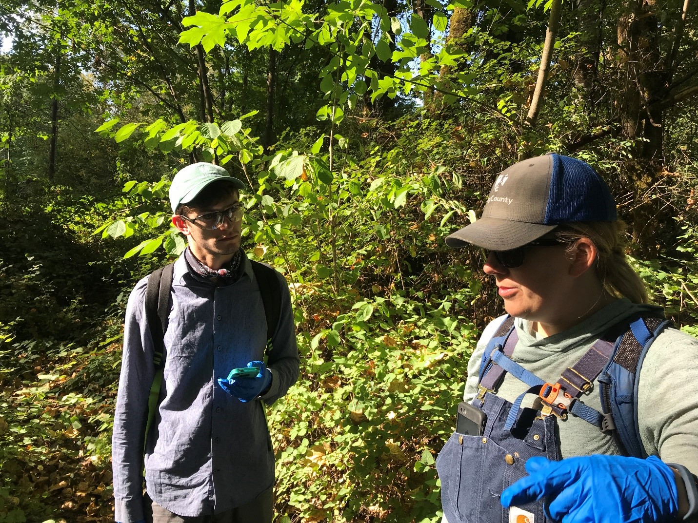
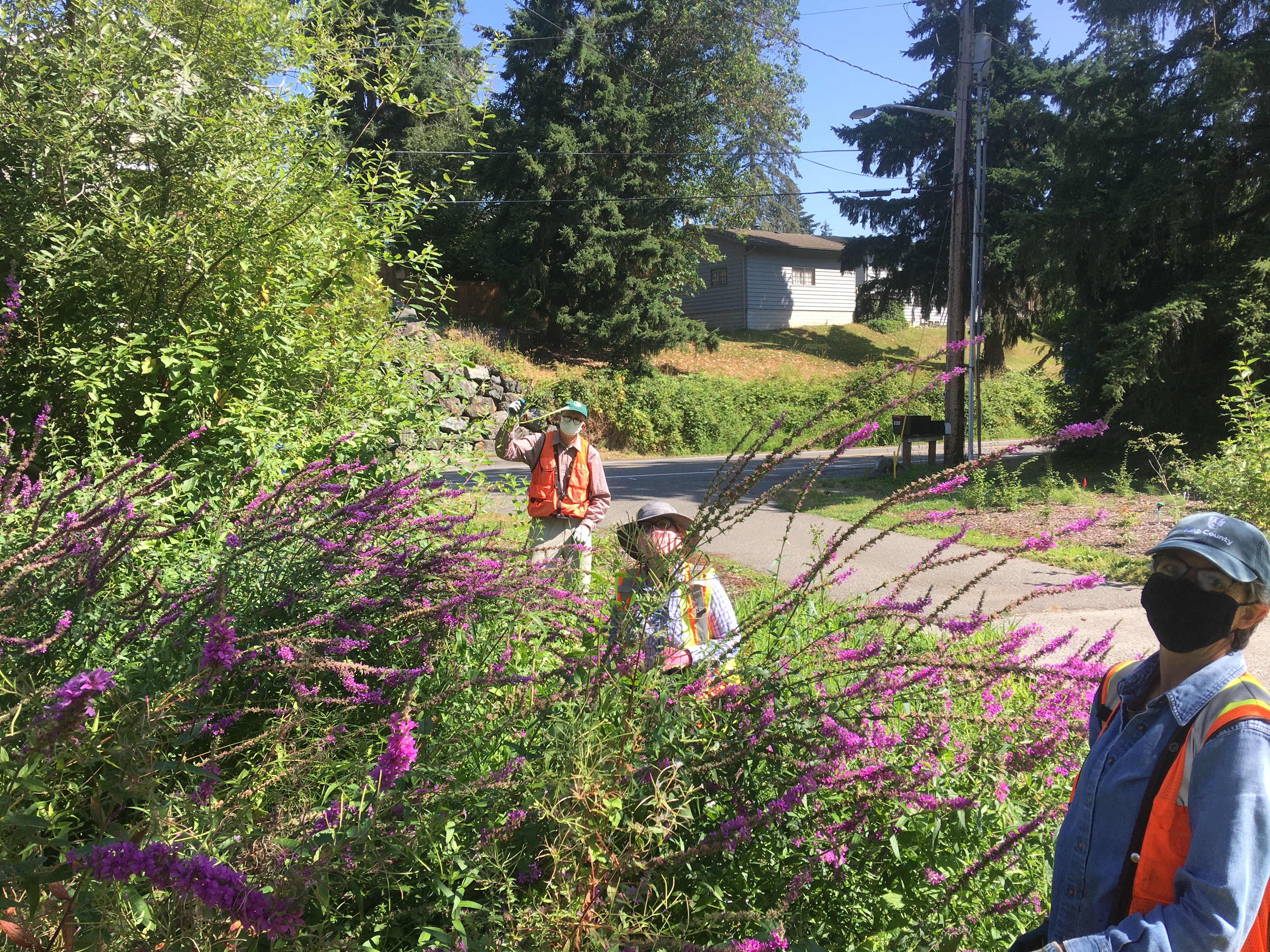
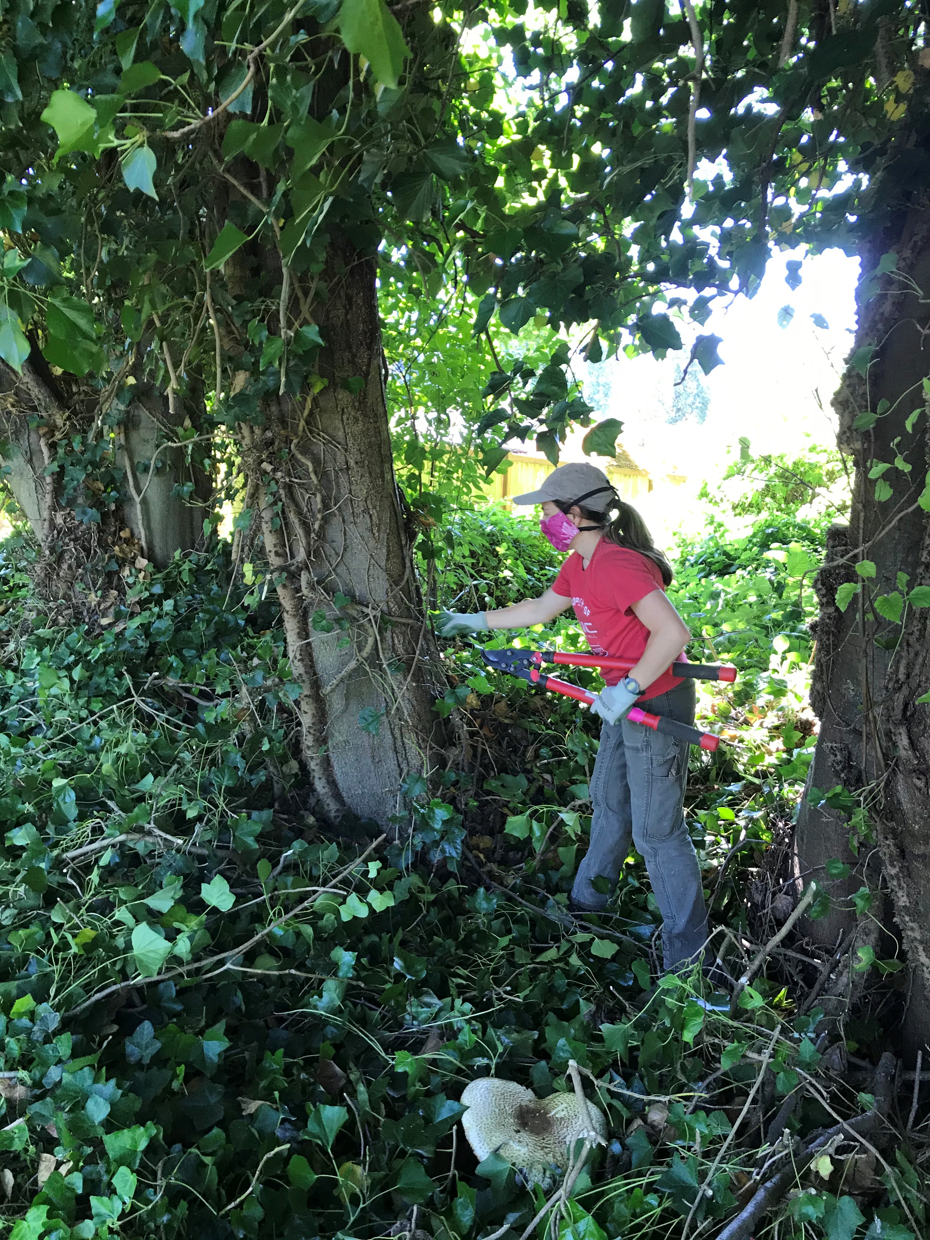
What does it take to be a Noxious Weed Control Specialist with King County? Prior to the pandemic and public health social distancing measures, author Gavin Tiemeyer spent the day on the Cedar River with Sayward Glise and Matthew Martin in order to find out. The short answer: knowledge, a sharp eye, a good attitude, and a trusty pair of blue work overalls.
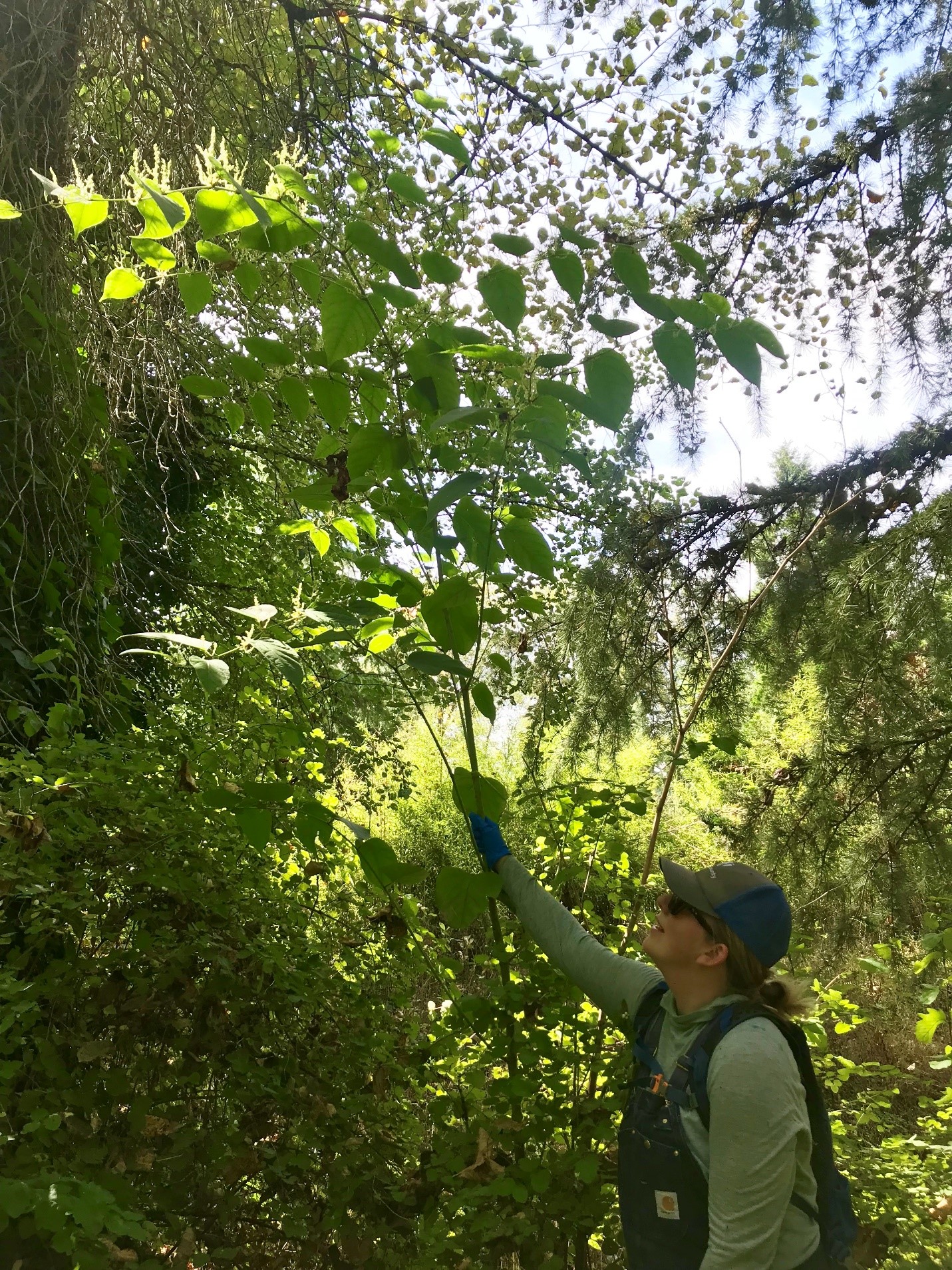
Matthew Martin and Sayward Glise follow an area along the Cedar River known as Buyer’s Curve, in search of hiding knotweed plants.
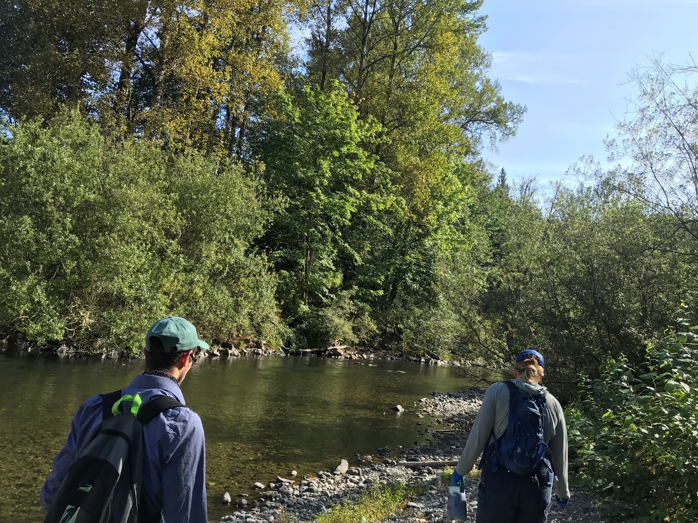
It was 9 a.m. on a sunny morning near an area along the Cedar River known as Byer’s Curve in unincorporated King County. At first glance, what appears to be a nondescript green-space, nestled between two residential properties, is actually a bustling riparian ecosystem with plants and animals competing for sunlight and water.
This is where the noxious weed control specialists will search for — and try to eliminate — knotweed and garlic mustard, two tenacious invasive species of plant that, left unchecked, can wreak havoc on the river’s ecosystem.
“Knotweed is one of the most aggressive invasive species in North America, and it loves our rivers,” Sayward explained. “Once it gets established it quickly out-competes the native vegetation. Our mission is to control knotweed, improve water quality, and restore riverine habitat.”
Sayward Glise, Noxious Weed Control Specialist, inspects the looming stem of a flowering knotweed plant (2019).
Managing knotweed is a major undertaking for King County and is especially important along the Cedar River where control is regulated. Sayward explained that knotweed clones itself in big flood events on the river when the plant’s root base breaks apart easily and travels downstream to other locations.
The way the process works is this: working closely together, Sayward and Mathew move through the greenspace by “gridding” or “running transects” in order to track down knotweed.
“We move strategically through the space in an effort to get visual coverage of the entire site,” Sayward explained. “We use maps, our GPS track logs, landmarks, and lots of verbal communication to make sure that we are getting our eyes on the whole site, and hopefully finding every stem of knotweed.”
Mathew and Sayward plan out transects in order to find hidden knotweed (2019).
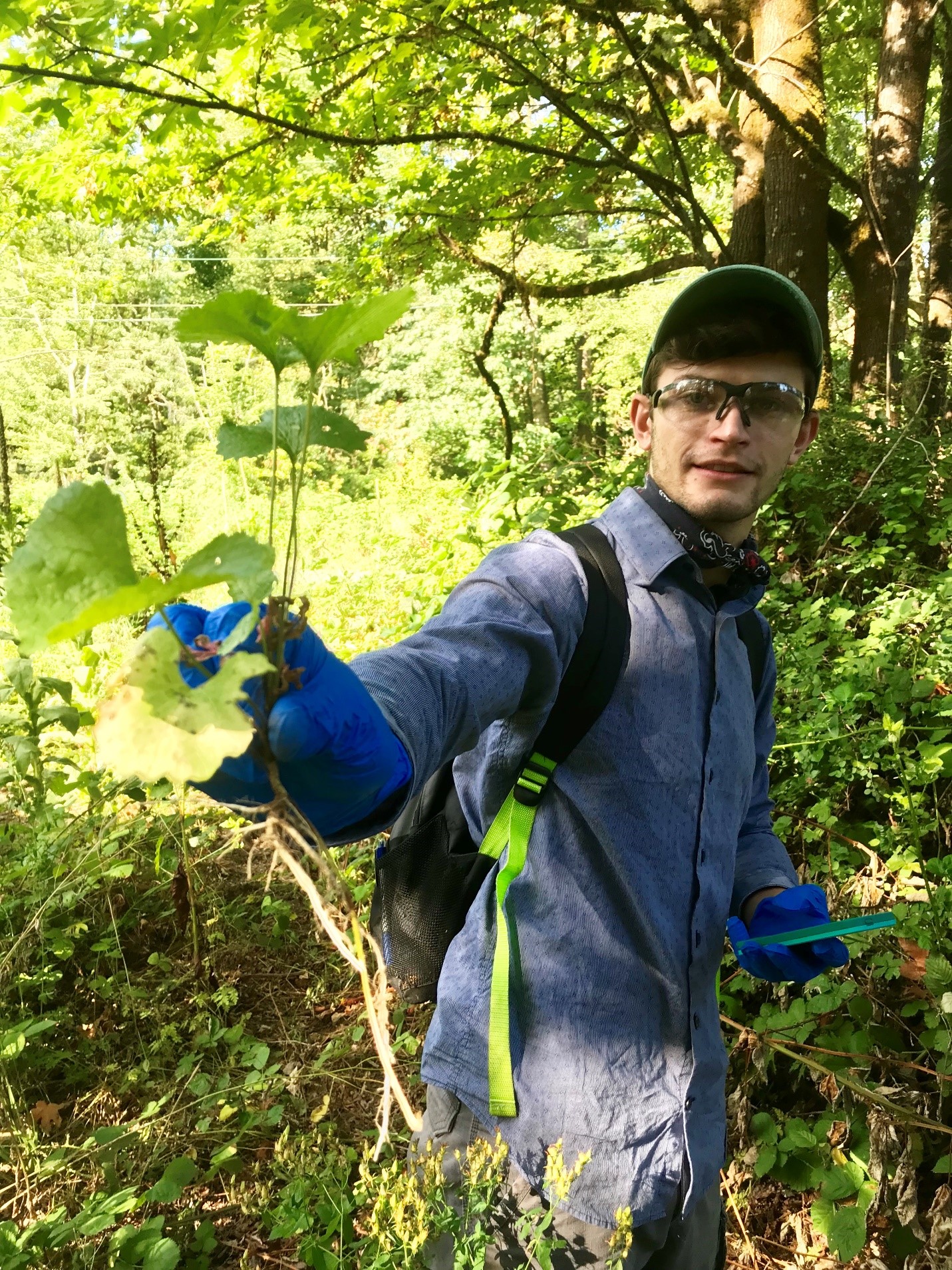
My job was to follow Sayward and Mathew around closely with a large black trash bag for proper disposal of litter and garlic mustard sprouts — another noxious weed that the county is required to control. I was amazed at how effortlessly they find the plants they are looking for. Matthew compared the process to the way birds of prey use shapes to hunt.
“Pretty much in here, I’m looking for leaf markings that aren’t jagged. Anything smooth,” Matthew said without breaking his stride. Taking his advice, I looked for smooth-edged leaves, but all I saw was a field of green plants. I was unable to distinguish between good and bad. It was like looking for a green needle in a green haystack.
Matthew displays a pulled-up garlic mustard weed, known for its rapid spread by seed into natural areas.
Our search for weeds brings us within a couple of feet of a neighbor’s property. A family looked over at us briefly as they stained their back porch but seemed undisturbed by our presence.
“Do they know what we’re doing here” I asked Sayward, a little nervous about creeping in the woods so close to their house.
“Oh yeah. I called them earlier this week to let them know we were coming,” she said.
A crucial component of the work King County’s Noxious Weed control team involves establishing and maintaining good, communicative relationships with property owners. This makes sense, considering plants don’t decide where they’ll grow based on property rights. Some property owners can be leery of the presence of county employees though, requiring a good ambassador to communicate the mission of the Noxious Weed Control Program, while listening to the concerns and curiosities of the public.
Sayward Glise is just that person. Friendly and knowledgeable, with plenty of mom power, Sayward embodies King County’s good neighbor policy. Her kindness and passion for the work are apparent both in her enthusiasm to teach me and the way she interacts with neighboring property owners over the course of the day. She is a face they can trust.
On the origin of her career with King County, Sayward explained that she started with EarthCorps, and was able to network with King County project managers while doing work on the Cedar River. After some seasonal positions in the Noxious Weed Control Program, Sayward went after, and got, a full-time gig.
Knotweed plants don’t stand a chance when Sayward comes to town (2019).
Despite the hard work, Matthew and Sayward praised the job they have. Though, occasionally a blackberry plant can stab you in the face.
“You go from a scream of frustration to busting out in laughter, because this is such a weird and unique job,” said Sayward.
For Sayward, after a busy day of treating knotweed, it’s common to go home and see the plant’s lime green leaves when she closes her eyes.
“I dream of knotweed,” she said.
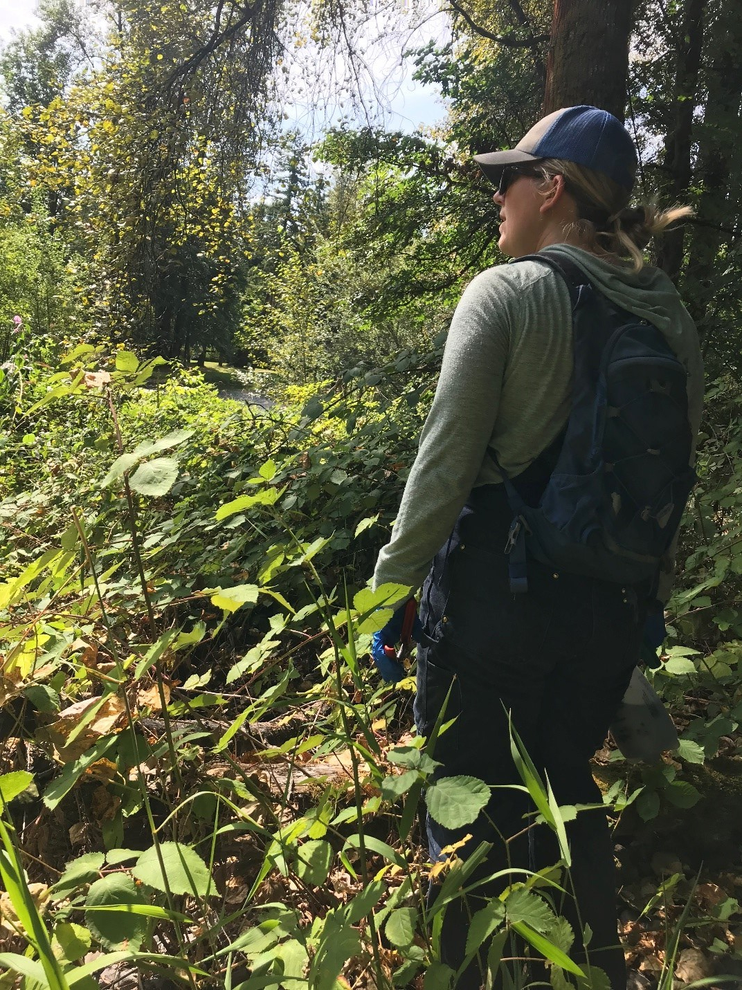
For Mathew and Sayward it’s especially important to find invasive plant species taking up valuable space along the riparian habitat of the Cedar River (2019).
By midday our search led us to an area along the Cedar River dominated by dense thickets of butterfly bush, another invasive species that can quickly out-compete native plants. Honeybees seem to love it, but Sayward explained that the larvae of native butterflies don’t like to eat the leaves. Apparently, invasive weeds escaped from victory gardens generations ago giving the plants a mythical quality.
Matthew spotted a large patch of flowering knotweed across the river and without hesitation waded into the knee-deep water to treat the plant on the other side. On days that are particularly hot, he explained, jumping into the river provides a welcome respite from the heat.
I first met Matthew while he was representing the Noxious Weed Control Program at the Duwamish River Festival. A recent graduate from the Environmental Science Program at the University of Washington, he is well equipped for the job. Using expert eyes, or what you may think of as a hawk-like vision, he spots plants one-by-one. Following him around with my black trash bag, he quickly outpaced me. I was sweating and regretting leaving my water bottle in the work truck.
The work Matthew and Sayward perform requires an attention to detail and knowledge of the land you can’t learn in a day. Using software on her phone, Sayward showed me a bird’s eye view of the zig-zag transects we’d made over Buyer’s Curve. Still more knotweed to find. Sometimes the invasive weed is a tiny seedling, other times it’s full-grown and hiding in plain sight.
To find every last noxious weed in Buyer’s Curve we methodically move through the green space. Up and over nursery logs and through chest-high snowberry bushes, or “bee motels,” and “snowberry spider parties,” as Sayward calls them.
“It’s kind of new age, but I have this intuition, like a little voice that whispers, ‘over here,’” Sayward said. (I look in the snowberry to make sure nobody is secretly following us.)
Sayward points to English Ivy, another tenacious invasive plant species, climbing up Cottonwood trees.
Between the three of us and the handful of plants we aim to eliminate, there were thousands of other living things going about their earthly business. The sights, sounds, and smells were evidence of this. It was easy to take for granted the soothing sound of moving water around us. The air had an intoxicating smell of ripe blackberries with a hint of cottonwood from the trees lining the river. Every sensory detail was heightened by the inhalation and exhalation of the woods. In the tranquility of our little green patch, it was hard to imagine the change that was happening from the impact of invasive species and climate change.
Sayward pointed out a garry oak seedling in the grass below us.
“I’m always excited to see these little guys growing out here.”
Garry oaks are a reminder of a time past when the Pacific Northwest was stewarded by the first people with the help of fire. “I think in no time this place will be a healthy riparian ecosystem again,” she said.
A day at the “office.”
The big payload at the end of the day was a large patch of mature knotweed on a property adjacent to the green space we had been working through. Sayward explained the property had recently been acquired as open space, to be managed by the county, through a voluntary sale by the owner and she had been waiting patiently to “take care of business.”
The property was large with a derelict greenhouse and a family home situated on the bank of the river. It was odd to look at a house so recently occupied by people that was now scheduled for demolition.
“Or you can think of it as prime habitat being reintroduced to the floodplain,” said Matthew.
When the work was done, we brushed off our boots to make sure we weren’t transferring unwanted plant seeds with us — a critical step that all field staff must do.
On the ride home I was exhausted and fighting to stay awake. I briefly dozed off in the backseat of the work truck. When I woke up, we are on I-90 just outside of Seattle. Then I saw it. Lime green, heart-shaped leaves, with little bunches of milky-white flowers. Knotweed hiding in plain sight. From now on, I will see it everywhere.
Gavin Tiemeyer is a graduate of The Evergreen State College where he studied environmental communication. He was a communications intern with the King County Department of Natural Resources and Parks in 2019 where he spent time in the field with employees of the Water and Land Resources Division to detail some of the work they do along rivers and streams to ensure clean water and healthy habitat in King County.
On June 16, field scientists from the King County Environmental Laboratory were collecting routine water quality samples aboard the research vessel, SoundGuardian, in the Central Basin of Puget Sound. As they were sampling, they noticed some patchy, brown coloration at the water’s surface at several sites visited that day.
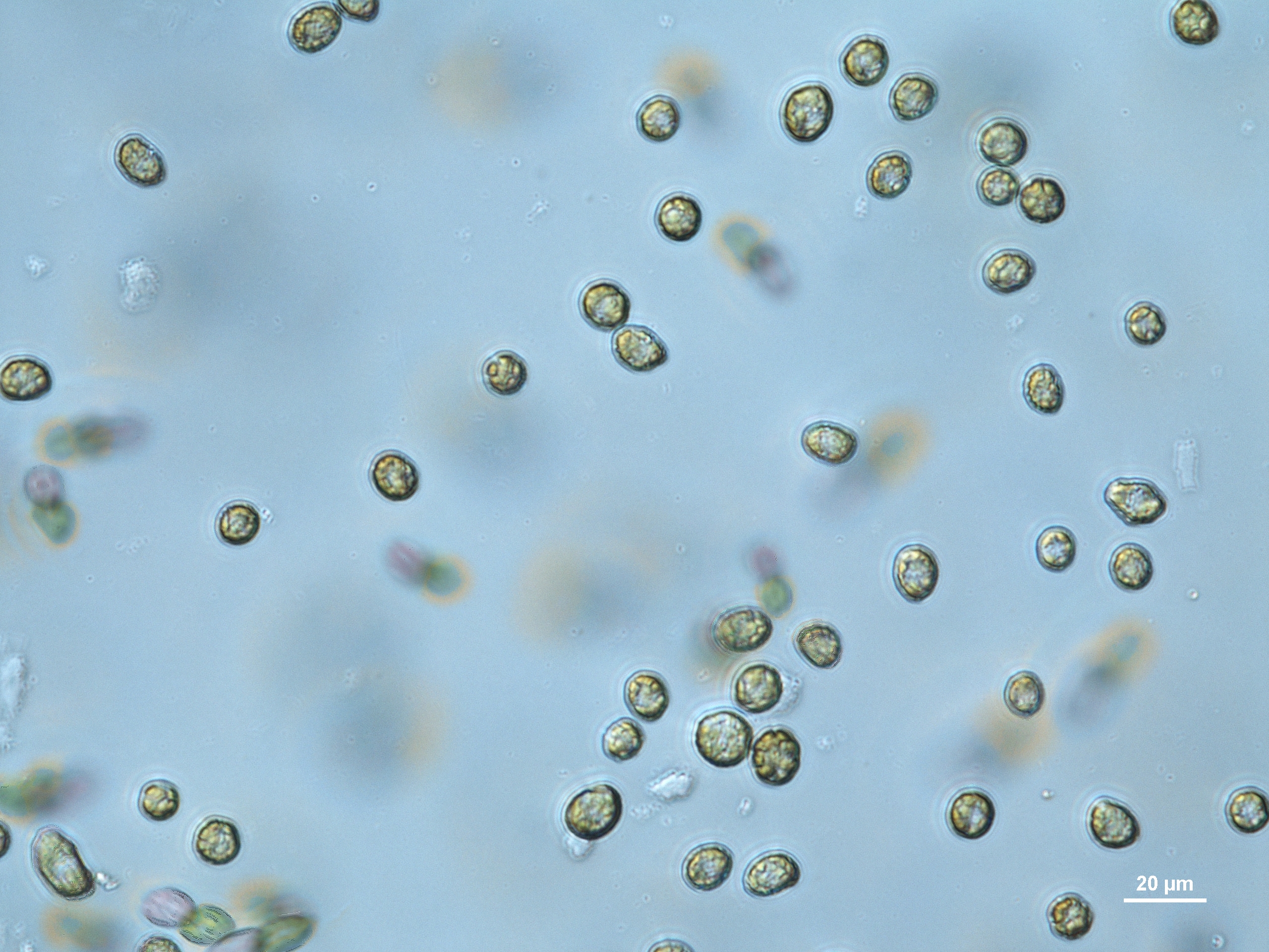
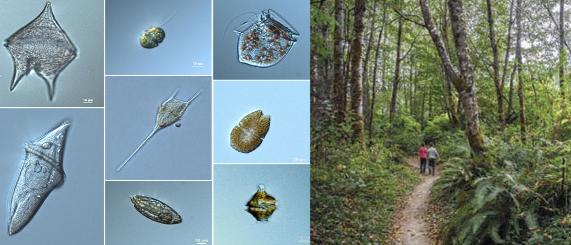
Blooms of Heterosigma akashiwo can develop very quickly and form conspicuous brown patches at the water’s surface where they congregate during the day. This flagellate can bloom in high numbers multiple times per season. (Photo: Gabriela Hannach)
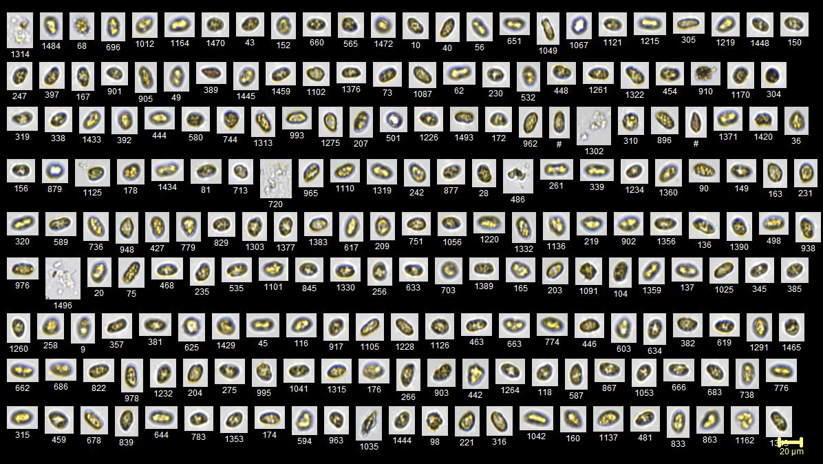
The samples were analyzed and determined to be a dense bloom of a tiny, harmful flagellate known as Heterosigma akashiwo. A regular component of Puget Sound’s phytoplankton community, Heterosigma has the dubious honor of belonging to a group known as Harmful Algal Bloom (HAB) species. Heterosigma has been repeatedly associated with fish mortality.
The highest concentration of Heterosigma measured in the last six years reached 2 million cells per liter in the protected waters of Quartermaster Harbor. Last week’s bloom reached numbers as high as 4 million cells per liter. Cell densities of this magnitude are rarely observed in Puget Sound’s main basin. It is the largest Heterosigma bloom King County scientists have observed in the history of the phytoplankton monitoring program in Puget Sound’s Central Basin.
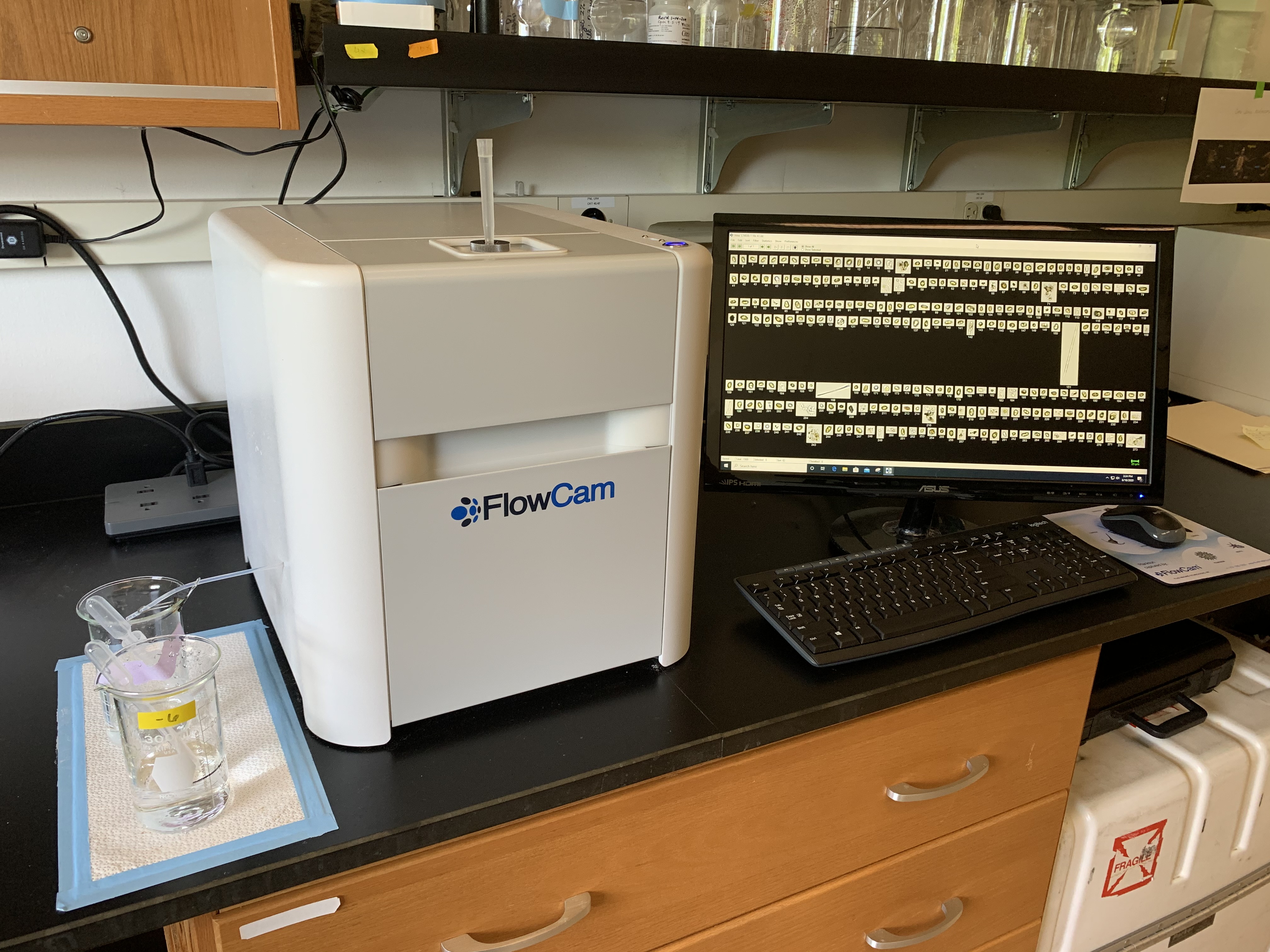
The FlowCAM instrument is an automated imaging microscope used at the King County Environmental Lab to study phytoplankton cells in water samples. (Photo: Lyndsey Swanson)
A common and globally distributed coastal species, Heterosigma often blooms in shallow recesses of Puget Sound’s shoreline, but much less frequently in the mixed waters of its three deeper basins.
Puget Sound is home to many different types of HABs that exhibit a wide range of troublesome effects for people and wildlife. Heterosigma has long been associated with fish kills and while the exact mechanism is not yet clear, there is some evidence that it produces hydrogen peroxide (a reactive oxygen species) which can cause gill damage and lead to anoxia and respiratory failure.
Scientists believe the explosion of Heterosigma cells was enabled by a period of rainy weather that established a stable surface layer of nutrient-rich, low-salinity water where these cells could thrive and reproduce readily. It is extremely unlikely the bloom was related to the West Point Treatment Plant as the bloom is occurring all over central Puget Sound; the plant’s performance has been normal with no overflows; and the effluent quality has been excellent.
A clear relationship between Heterosigma blooms and rising spring temperatures has been documented in field studies, suggesting that as the average global temperature rises, we could see an increase in the frequency of blooms of this toxic flagellate in Puget Sound waters.
Above are microscopic photos of individual particles detected in water samples arranged in a collage by the FlowCam instrument. The golden, oval-shaped particles in this collage are Heterosigma akashiwo collected from the recent bloom. (Photo: Gabriela Hannach)
Since 2008, the King County Environmental Laboratory has monitored the phytoplankton community of the Central Basin of Puget Sound, using microscopy to document the enormous variety of phytoplankton that inhabit these waters.
King County shares data with local agencies to share and inform aqua-culturists and other relevant agencies as an advanced warning, thereby helping to protect local industry from the potentially deleterious effects of this harmful species.
Heterosigma akashiwo is a small, photosynthetic flagellate common to Puget Sound waters. It is best known for its cartwheeling swimming pattern, cornflake-like appearance, and association with fish kills. (Video: Lyndsey Swanson)
Sources
Cochlan,W.P., Trainer, V.L. Trick, C.G., Wells, M.L., Eberhart, B.-T. L., Bill, B.D. 2013.Heterosigma akashiwo in the Salish Sea: defining growth and toxicity leading to fish kills. Proceedings of the 15th International Conference on Harmful Algae.
Glibert, P.M., Anderson, D.M., Gentien, P., Grane´li, E., Sellner, K.G., 2005. The global, complex phenomena of harmful algal blooms. Oceanography 18 (2), 136–147.
Taylor, F. J. R., Haigh, R. 1993. The Ecology of Fish-Killing Blooms of the Chloromonad Flagellate Heterosigma akashiwo in the Strait of Georgia and Adjacent Waters. In: Smayda, T. J. and Shimizu, Y. (eds.). Toxic Phytoplankton Blooms in the Sea. Elsevier, Amsterdam. 705-771
Horner, R. A. 2002. A Taxonomic Guide To Some Common Phytoplankton. Biopress Limited, Dorset Press, Dorchester, UK. 200.
Steidinger, K.A. & Meave del Castillo, M.E. [Eds.] 2018. Guide to the Identification of Harmful Microalgae in the Gulf of Mexico.(Vols. I-II). St. Petersburg, FL; DiggyPOD, Inc.
Swanson, L.M, & Hannach G.; “Harmful Algal Species in the Central Basin of Puget Sound: Seasonal Bloom Patterns Analyzed Via FlowCAM Technology.” Salish Sea Ecosystem Conference 2020 (Digital poster presentation). King County Environmental Laboratory, Seattle, WA.
Rensel, J.E.J., 2007. Fish kills from the harmful alga Heterosigma akashiwo in Puget Sound: Recent blooms and review.


![Help wanted: Must love benthic macroinvertebrates. [The Water and Land Resources Division at work.]](https://kingcountywaterandland.wordpress.com/wp-content/uploads/2020/09/sb-3.jpg?w=825&h=510&crop=1)